Chosen By: Allison Wells, Senior Director, Communications Location: Boothbay Harbor, Lincoln County Description: A Boothbay Region Land Trust preserve that extends over two spruce and fir clad peninsulas in the lower tidal reaches of the Sheepscot River system between Boothbay and Edgecomb. Oven’s Mouth is a narrow gut through which flows an immense quantity of Read More
Explore Maine Map locations
Penobscot Mountain—Sargent Mountain hike, with swim at Sargent Pond
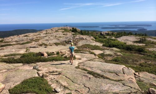
Chosen By: Pete Didisheim, Senior Director of Advocacy Location: Acadia National Park, Hancock County Description: To hike the Penobscot Mountain—Sargent Mountain loop, go to the Jordan Pond House and walk behind the building, to the left, to find the trailhead marker. The trail winds through woods, over streams, crosses the famous carriage roads, and includes Read More
Popham Beach
Chosen By: Beth Comeau, Communications Manager Location: Phippsburg, Sagadahoc County Description: Popham Beach is a sandy beach near Fort Popham, at the mouth of the Kennebec River. It’s near the site of the short-lived Popham Colony, founded in 1607 and abandoned the following year. Farther down the beach is Popham Beach State Park, a state Read More
Smalls Falls
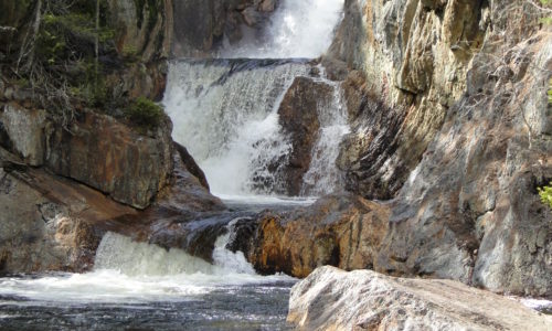
Chosen By: Beth Comeau, Communications Manager Location: Madrid, Franklin County Description: A 54-foot waterfall on the Sandy River Activities: Swimming, hiking, photography, picnicking Favorite season to visit: Early fall Why it’s special: This waterfall is beautiful! You can hike up to the top, swim in the fresh, clean water at the bottom of the falls, Read More
Upper Androscoggin River
Chosen By: Allison Wells, Senior Director, Communications Location: Gilead to Bethel, Oxford County Description: A six-mile excursion from Gilead to Bethel along a beautiful stretch of the Androscoggin River. The paddle, at a leisurely pace, takes three to four hours and winds through the spectacular beauty of the Mahoosucs, the northernmost extension of the White Read More
Tunk Lake Area, including Donnell Pond and Spring River Lake
Tunk Lake Area, including Donnell Pond and Spring River Lake Location: In and around Township 10 SD, 12 miles east of Ellsworth, Hancock County Description: The Donnell Pond Public Reserved Land unit includes mountains, pristine lakes, and remote ponds all spread out over 14,000 acres in eastern Maine. There are sites for camping along the pond’s beaches, Read More
Pocomoonshine Lake
A Land for Maine’s Future program grant helped the Maine Department of Inland Fisheries & Wildlife acquire land alongside the Town of Princeton’s boat launch on Pocomoonshine Lake. The increased lake frontage will allow for parking and a turnaround at this popular sport fishing site, and will create safer opportunities for swimming (situated farther from Read More
Presumpscot River Preserve and Walton Park Water Access Site

Before its waters were harnessed for dams and polluted with industrial waste, the Presumpscot was a clear and swift-moving river that plunged over 12 sets of falls in its 24-mile course from Sebago Lake to Casco Bay. Improvements in water quality have renewed recreational interest in the river, after decades in which people kept far Read More
Rangeley Lakes Region
The Land for Maine’s Future (LMF) program has helped to conserve three recreational gems in the Rangeley Lakes region. An LMF grant enabled Rangeley Lakes Heritage Trust to purchase Bald Mountain from International Paper. The Trust subsequently transferred this 1,873-acre tract to the Bureau of Parks and Lands for management as the Bald Mountain Public Reserve. A Read More