Indian Cellar Preserve contains roughly three miles of trails that lead to the mouth of the Saco River. A 1.6-mile perimeter trail wraps around the river, with several additional interior trails. The site divides the towns of Buxton and Hollis. Visitors can enjoy a variety of outdoor activities at the site during all four seasons, Read More
Swimming
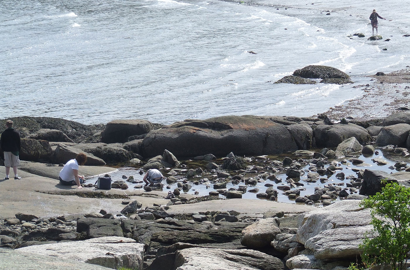
Do you have a favorite summer swimming hole? A place that you like to spend warm summer days in Maine? Here are some great spots to visit for a swim with your family and friends to enjoy Maine's clean, refreshing waters.
Pleasant Mountain Preserve
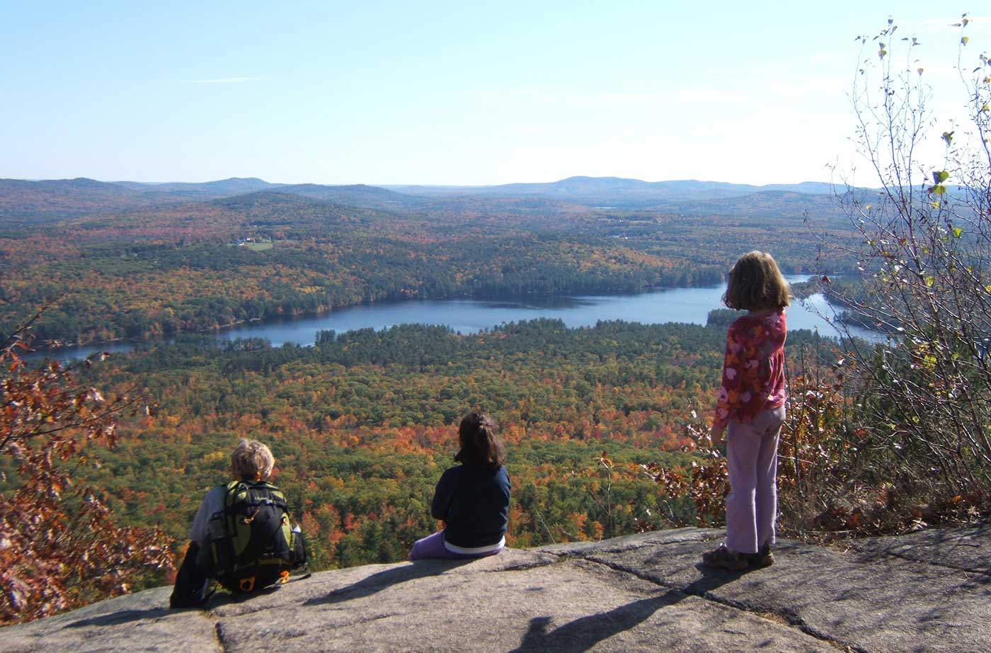
Pleasant Mountain Preserve is located in Bridgton and Denmark, bordered by the Upper Saco River (west), Moose Pond (east), Kezar Pond (north), and Beaver Pond (south). The area’s proximity to both Portland and Boston makes it an important environmental, economic, and recreational spot. Pleasant Mountain (2,006 feet) is one of the key elements of the Read More
High Island Preserve
High Island Preserve is located just off the eastern shore of St. George near the confluence of Tenant’s Harbor and Long Cove. After decades of interest and effort, Maine Coast Heritage Trust was finally able to purchase the island in 2016 with the help of a grant from the Land for Maine’s Future program. The Read More
Prescott Field Trail System Accessible Trail
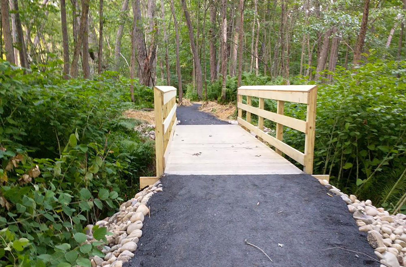
High Peaks Alliance and University of Maine Farmington created this 0.6-mile Universally Accessible Trail as a part of the trail system around Prescott Field located on the University of Maine Farmington’s campus. The trail starts in a river floodplain and takes visitors through a silver maple forest, across a bridge, and to a swimming spot Read More
Aroostook State Park
In a rolling landscape dominated by farms, Quaggy Joe Mountain presents a prominent profile. Alongside it lies Echo Lake, a popular brook trout fishery and swimming destination. Both these recreational resources lie within Aroostook State Park, the first state park ever created in Maine (in 1939). The Park, just five miles south of Presque Isle, draws Read More
Birch Point State Park Addition
A grant from the Land for Maine’s Future program allowed the Maine Department of Conservation to acquire land needed to complete public ownership of the beach, protecting the site’s natural character by buffering it from development. Known for its gentle surf and brisk waters, the attractive crescent-shaped beach at Birch State Point Park (known locally as Lucia Read More
Burnt and Sheep Islands
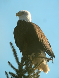
Two undeveloped islands off North Haven, 15-acre Burnt Island and 25-acre Sheep Island, support two pairs of nesting Bald Eagles that are among the most successful in the state. Between 1970 and 1989, the Burnt Island eagle pair (or their successors) raised more than 21 eaglets, according to Charlie Todd, a wildlife biologist with the Read More
Casco Bay Islands (Flag, Mark, & Whaleboat)
Fast-growing residential growth along Casco Bay has fragmented and destroyed much wildlife habitat. For the species that remain, the undeveloped islands in the eastern Bay provide a critical resource. The Land for Maine’s Future (LMF) program has helped to protect three of these islands: 11-acre Mark, 27-acre Flag, and 125-acre Whaleboat. Mark Island is one Read More
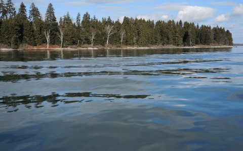
Cold Rain Pond
The good water quality of Cold Rain Pond, near Sebago Lake, supports a thriving cold-water fishery. Lying in an increasingly populous area, this water body is remarkably undeveloped. Only one camp fronts on this “great pond” and a conservation easement held by Loon Echo Land Trust protects most of that private property from further development. No Read More