NRCM's special report, Maine’s Ecological Reserves: Meeting the Promise of Saving All the Pieces, includes stunning illustrations from Maine-based artist Zoe Keller to describe the value of the state's ecological reserves and details compounding threats to Maine’s wildlands that reinforce now is the time to protect the full range of Maine’s habitats.
On March 29, 2022, Governor Mills signed into law LD 736, a bill to enhance Maine's ecological reserve system.
Public Reserved Lands
What are Public Reserved Lands?
Maine has approximately 600,000 acres of Public Reserved Lands in 37 separate parcels located across the state. These lands are enjoyed for their outstanding hiking, camping, birding, fishing, and hunting opportunities. They include the Bigelow Preserve, Kennebec Highlands, Tumbledown, Cutler’s Bold Coast, Donnell Pond, Debouillie, Mount Abraham, and other Maine gems. (Please check out this map from the Department of Agriculture, Conservation, and Forestry to see the full list.)
How are Public Reserved Lands Managed and Maintained?
Maine’s Public Reserved Lands are managed by the Bureau of Parks and Lands (BPL) for multiple uses, including wildlife habitat, outdoor recreation, and sustainable timber harvesting.
Maine’s Public Reserved Lands include some of the best, largest, and oldest trees in the state. Stands with big, old trees are not only economically valuable, but they also provide some of the best remaining habitat in Maine’s forests for those plant, bird, and mammal species that thrive in older forests. In addition, they are part of ecosystems that provide clean air and water, prevent erosion and flooding, and store large amounts of carbon, among other benefits to society.
For most of its history, BPL has harvested timber from Public Reserved Lands’ forests in a sustainable manner, improving both the quality and the quantity of timber on those lands. Under the LePage Administration, however, Public Reserved Lands were regularly under attack: the former governor attempted to increase timber harvesting to unsustainable levels and needlessly restructure public land management. The LePage Administration also attempted to siphon off essential funding from harvests to be used for unrelated purposes. Fortunately, these attacks were largely unsuccessful, and under a new Administration BPL is back on track conducting good forestry and stewardship.
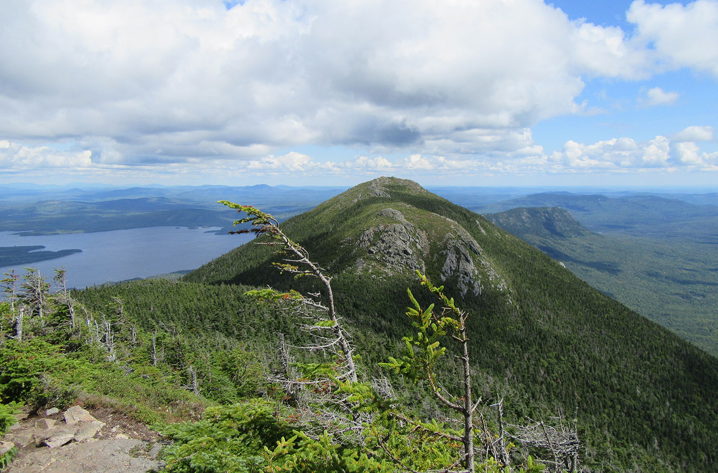
West Peak of Bigelow looking toward Avery Peak on Bigelow Public Reserved Land, by Linda Woods
Management of Maine’s Public Reserved Lands is entirely funded by revenues generated from the lands themselves, primarily from timber harvesting. All of the roads, trails, campsites, picnic tables, and other recreational infrastructure; all wildlife habitat and ecological protection activities; and all timber management and harvesting activities on Public Reserved Lands are paid for by the lands themselves. No taxpayer funds are used.
How are Public Reserved Lands Acquired?
Maine’s 600,000 acres of Public Reserved Lands are a unique state resource. Their origin dates back to the separation of Maine from Massachusetts in 1820. In 1820, the state set aside lots in each unincorporated township from private sale in order for this land to provide various public benefits. In the 1970s, these dispersed public lots were consolidated into the spectacular Public Reserved Land System that we have today. These consolidated lots provide timber, protect wildlife habitat, and offer a wide variety of public recreational opportunities. These lands are held in public trust and managed for public use and enjoyment.
Additional public funding for acquiring new Public Reserved Lands comes from the Land for Maine’s Future (LMF) program, the federal Forest Legacy Program, or from private philanthropic donations. NRCM strongly supports all of these funding sources. Please read more about NRCM's support of the LMF program.
Ecological Reserves
On August 11, 2000, a Maine state statue took effect creating the Ecological Reserve System, managed by BPL. Ecological reserves are an important part of Maine's conserved lands and are valuable lands for outdoor recreation. They were established for three primary purposes:
- To serve as a benchmark for environmental and biological change over time and function as sites for research and education.
- To maintain representative examples of all the habitat types found in Maine.
- To protect habitat for wildlife that may not be protected on other lands.
The State, by establishing the Ecological Reserve System, intended to acquire land representative of the different habitat types in each of the different biophysical regions that are found throughout the state. As of 2020, 19 sites – each of which are segments of Public Reserved Land – covering more than 90,000 acres comprise the Bureau of Parks and Lands' Ecological Reserve System. Ecological reserves include some of Maine's most iconic locations for backcountry recreation, including the Bigelow Preserve, Cutler Coast, Deboullie, and the Mahoosucs Public Reserved Land.
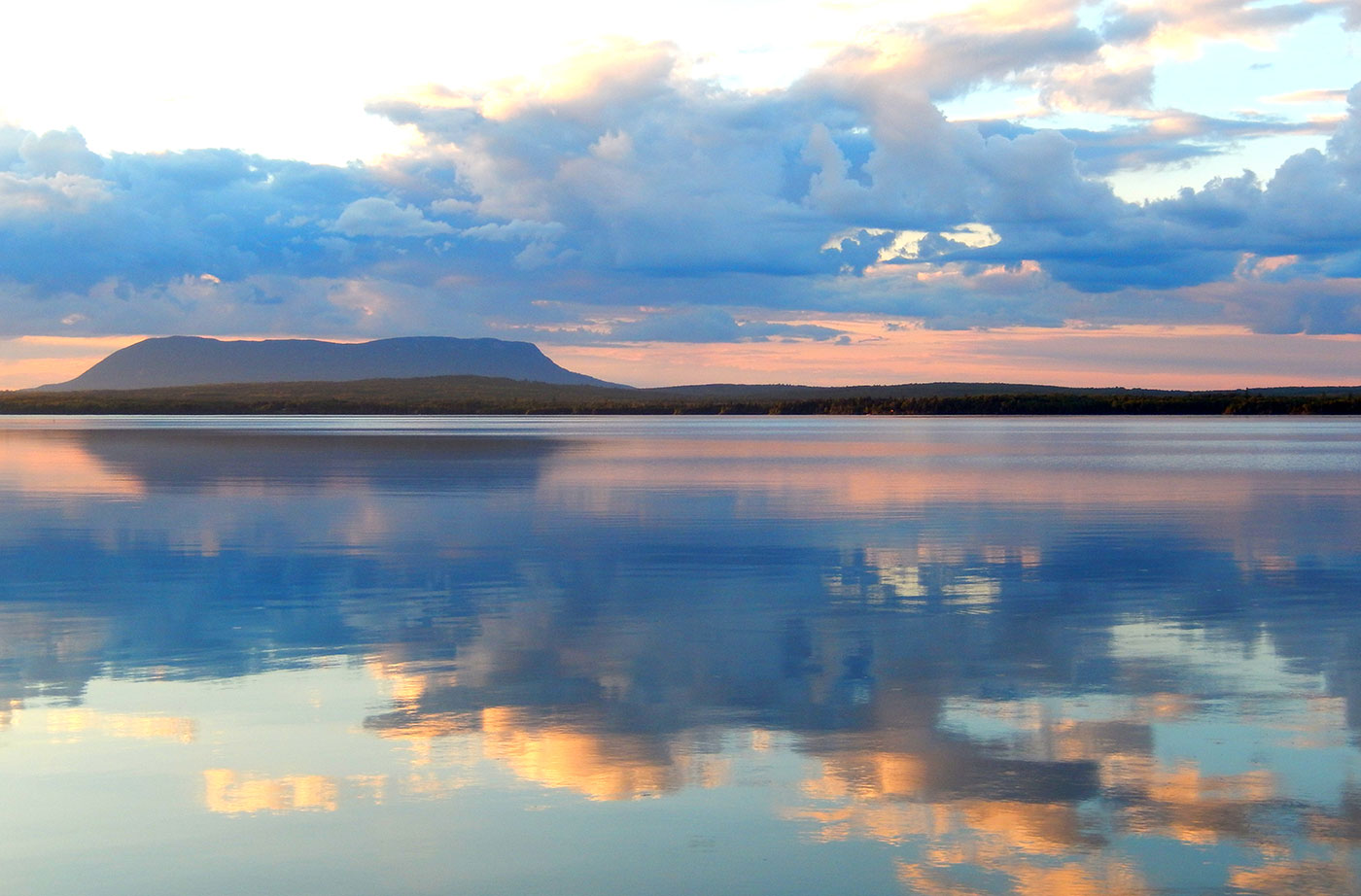
Big Spencer Mountain, part of the Big Spencer Ecological Reserve, from First Roach Pond by Kathy Maxsimic
The Maine Natural Areas Program conducts a continuous forest inventory on ecological reserves to monitor changes over time. Field sites are revisited on a 10-year interval and provide valuable information on how ecological reserves compare to managed forests; how Maine forests are responding to climate change; and the rates of carbon sequestration and storage within ecological reserves. Numerous independent research projects have also been conducted in ecological reserves addressing:
- Climate change
- Monitoring plants and animals with unique habitat requirements
- Old forest habitat
The Maine Forest Biodiversity Project included initial work on documenting sites worthy of becoming ecological reserves in the 1990s. The effort spearheaded by Janet McMahon, produced a report in 1998 that identified 69 potential reserve sites covering 498,700 acres, or just 2% of the state's total land area. In 2014, the Maine Natural Areas Program examined how well habitats are represented in Maine’s conserved lands and concluded that each of Maine’s seven ecoregions contain forest types that are under-represented in Ecological Reserves.
Unfortunately, the law creating Ecological Reserves limited the amount of land that can be designated under the program. Those statutory limits are preventing important conservation from being accomplished and should be removed so BPL has the option of acquiring more ecological reserve land.
Ecological reserves are open for to fantastic backcountry hiking, camping, hunting and fishing. For more information on recreation opportunities within each ecological reserve, check the website of the Maine Bureau of Parks and Lands.
State Parks
Maine has 48 State Parks and Historic Sites, protecting more than 100,000 acres of land and offering diverse recreational opportunities throughout the state.*
With gems including Aroostook State Park, Mount Kineo, Rangeley Lakes, Grafton Notch, Bradbury Mountain, Crescent Beach, and Quoddy Head, Maine’s State Parks are very popular: the Maine Bureau of Parks and Lands recently announced that 2020 saw the highest visitation ever to the Maine State Parks system with more than three million total visits. In 2021, Maine's state campgrounds broke a visitation record as well with 315,000 campers — a 12% increase over 2020.
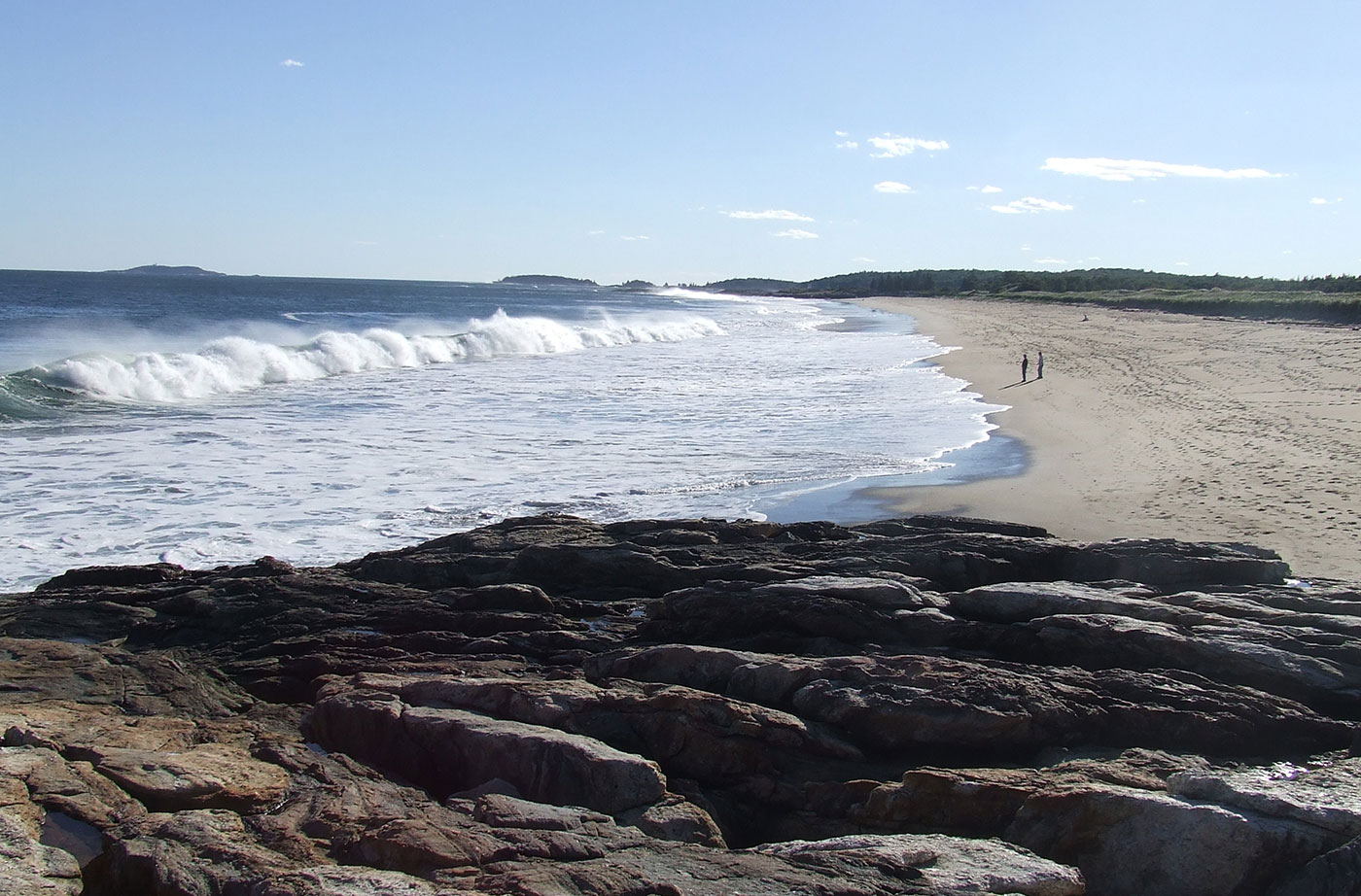
Reid State Park, Georgetown, by Allison Wells
The $50 million Maine State Parks received through the American Rescue Plan Act funding allocated to the state will address the entire maintenance backlog at State Parks. The funds will ensure that the State can make high-priority repairs so that Maine residents and tourists alike have safe, accessible, and positive visits to Maine’s protected lands.
For a longer-term solution to the maintenance backlog, NRCM supports dedicating a percentage of revenues generated from park visits to maintaining the quality and safety of State Parks, roads, and facilities.
*Baxter State Park is a separate entity from the State Park System, as it has an independent management structure.
Banner photo: View from Bigelow. Photo by Pete Didisheim