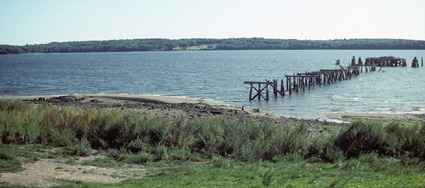
Recognizing the need for greater shore access around Inner Penobscot Bay, the State had long sought a property that could provide area residents with a site for swimming, sunbathing, picnicking and windsurfing. A 100-acre property on Sandy Point in Stockton Springs offered all the attributes the State had been seeking–with more than a half-mile of Read More
Wildlife Watching
Maine is home to many iconic species of wildlife—the Common Loon, black bears, Canada lynx, Osprey, and of course, moose! Exploring Maine's outdoors often offers you a glimpse of these beautiful creatures. Learn more about Maine wildlife in our Creature Feature. Explore these locations for a chance to see Maine's wildlife up close. Please remember to leave their nests, dens, and young offspring alone if you come across them while exploring.
Sawyer Mountain Highlands
The Sawyer Mountain Highlands rise more than 1,000 feet over the floodplains of the Saco, Ossipee, and Little Ossipee Rivers, supporting a diverse array of natural features. High ledges offer views out to Casco Bay and the White Mountains. For more than a decade, the Francis Small Heritage Trust (FSHT) has worked to conserve the natural Read More
Scarborough Beach
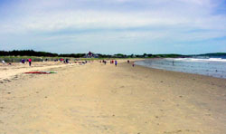
With a long expanse of white sand and views out to the rocky shores of Prouts Neck, Scarborough Beach is an attractive setting for swimming, walking, and picnicking. Surfers routinely ride its combers in and surf-casters ply the waters for striped bass and blue fish. In wintertime, local residents come to skate on Massacre Pond, Read More
Sebago Headwaters Preserve
With southern Maine’s landscape becoming more developed, the remaining large tracts of open space are an increasingly critical resource for wildlife and watershed protection. To conserve key lands in the Sebago Lake watershed Loon Echo Land Trust (LELT) asked the Land for Maine’s Future (LMF) program to help fund creation of a 1,558-acre Sebago Headwaters Preserve around Read More
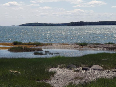
Sebago Lake Beach
A state study identified this 35-acre property along the eastern shore of Sebago Lake as one the eight most outstanding beaches in all Maine’s organized towns. The high-quality sand beach extends for 980 feet along the shore, fringed by stands of towering white pine interspersed with hardwoods. Given the extensive amount of development along much Read More
Seboeis Lake
A Land for Maine’s Future program grant enabled the Maine Department of Conservation (DOC) to acquire 789 acres of mature woodland and 5 miles of undeveloped lake frontage adjoining its 12,900-acre Seboeis Lake Public Reserved Land. The State’s “Wildlands Lake Assessment” rated Seboeis Lake as of “statewide significance,” due to its sparsely developed shores and Read More
Shackford Head
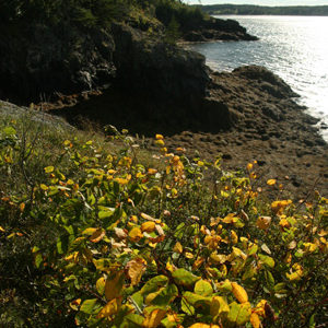
Shackford Head, with 2.5 miles of undeveloped shoreline marked by pebble beaches, natural arches, and sheltered coves, provides a wonderful vantage point from which to survey the Canadian islands of Campobello and Grand Manan as well as West Quoddy Head. The State’s purchase of this headland in 1989 ensured that the land would never again Read More
Skolfield Shores Preserve
At the town line between Brunswick and Harpswell on Route 123, a panoramic view opens out on both sides of the roadway, with historic farm structures flanked by wide fields leading down to tidal marshes and open water. These lands lie in the narrow isthmus at the top of Harpswell Neck, situated on a historic Read More
South Lubec Sand Bar
Sand beaches are a rare geological feature in downeast Maine, making this mile-long spit off Lubec even more unusual. It parallels the shore between West Quoddy State Park and the town of Lubec and can be seen from both settings. An extensive salt marsh lies along its landward side with a unique raised peatland known Read More