The Land for Maine’s Future (LMF) program has helped to conserve three recreational gems in the Rangeley Lakes region. An LMF grant enabled Rangeley Lakes Heritage Trust to purchase Bald Mountain from International Paper. The Trust subsequently transferred this 1,873-acre tract to the Bureau of Parks and Lands for management as the Bald Mountain Public Reserve. A Read More
Fishing
Many Maine public lands are open for fishing. Here are a few great spots for you to head with your fishing pole and tackle. Please be sure to visit the State of Maine website to learn about Maine's fishing rules and laws, and learn how to obtain a fishing license.
Round and Long Ponds
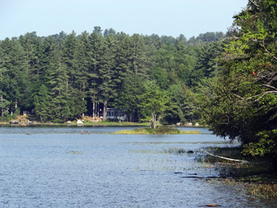
Knowing that Round Pond was a popular destination for fishermen seeking bass and brown trout, the Maine Department of Inland Fisheries & Wildlife (IF&W) began looking for a water access site on its shores more than a decade ago. Finally, in 2000, the State had an opportunity to acquire an attractive, wooded 17-acre parcel, bordering Read More
Salmon Brook Lake Bog
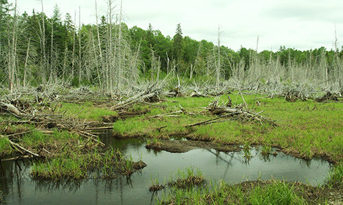
At 1,857 acres, this expansive northern white cedar bog (extending out from Salmon Brook Lake) supports an array of northern plant species rare in Maine. It is home to the white water lily, pygmy water lily, marsh valerian, northern valerian, swamp pink, swamp honeysuckle, small round-leaf orchid, purple pyrola, Lapland buttercup, and showy lady’s slippers. Read More
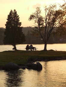
Scarborough Beach
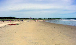
With a long expanse of white sand and views out to the rocky shores of Prouts Neck, Scarborough Beach is an attractive setting for swimming, walking, and picnicking. Surfers routinely ride its combers in and surf-casters ply the waters for striped bass and blue fish. In wintertime, local residents come to skate on Massacre Pond, Read More
Sebago Headwaters Preserve
With southern Maine’s landscape becoming more developed, the remaining large tracts of open space are an increasingly critical resource for wildlife and watershed protection. To conserve key lands in the Sebago Lake watershed Loon Echo Land Trust (LELT) asked the Land for Maine’s Future (LMF) program to help fund creation of a 1,558-acre Sebago Headwaters Preserve around Read More
Seboeis Lake
A Land for Maine’s Future program grant enabled the Maine Department of Conservation (DOC) to acquire 789 acres of mature woodland and 5 miles of undeveloped lake frontage adjoining its 12,900-acre Seboeis Lake Public Reserved Land. The State’s “Wildlands Lake Assessment” rated Seboeis Lake as of “statewide significance,” due to its sparsely developed shores and Read More
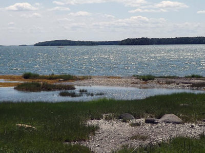
Sheepscot Pond
Recreational boaters and anglers have long enjoyed access to Sheepscot Pond via a boat ramp conveniently located on Route 3, midway between Augusta and Belfast. The pond, set amidst rolling, wooded hills in the southwestern corner of Waldo County, draws anglers in search of lake trout, brook trout, splake, landlocked salmon, white perch, smallmouth bass, Read More
Skolfield Shores Preserve
At the town line between Brunswick and Harpswell on Route 123, a panoramic view opens out on both sides of the roadway, with historic farm structures flanked by wide fields leading down to tidal marshes and open water. These lands lie in the narrow isthmus at the top of Harpswell Neck, situated on a historic Read More
Spednic Lake/Upper St. Croix River — St. Croix International Waterway
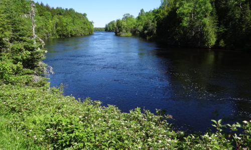
Since 1992, the Land for Maine’s Future (LMF) program has funded five projects along Spednic Lake and the upper St. Croix River, working with the Province of New Brunswick to preserve an exceptional, undeveloped corridor along the U.S.-Canada border. he LMF projects have protected more than 4,100 acres of land and 72 miles of shoreline Read More