Good afternoon Senator Davis, Representative Dunphy, and members of the Agriculture, Conservation and Forestry Committee. My name is Cathy Johnson. I am a resident of Alna and the Forests and Wildlife Project Director for the Natural Resources Council of Maine. I am here today on behalf of the 16,000 members and supporters of the Natural Read More
Opposition to LD 549, An Act to Recognize Preexisting Uses
Good afternoon Senator Davis, Representative Dunphy, and members of the Agriculture, Conservation and Forestry Committee. My name is Cathy Johnson. I am a resident of Alna and the Forests and Wildlife Project Director for the Natural Resources Council of Maine. I am here today on behalf of the 16,000 members and supporters of the Natural Read More
Kennebec Highlands — Kimball Pond
The 7 Lakes Alliance acquired a 278-acre property around Kimball Pond in Vienna. The property includes Kimball Pond’s headwaters (including areas prone to erosion), a tributary stream, and wetlands area. Kimball Pond is home to a popular fishing spot for brook trout. The Kimball Pond area is also home to sustainably harvested forestland. The goal Read More
LePage’s Campaign against North Woods Monument Will Only Hurt Maine
By Gail Fanjoy and Larry MacArthur, Special to the BDN Bangor Daily News op-ed On Feb. 14, Gov. Paul LePage wrote a letter to President Donald Trump asking him to rescind the executive order that created the Katahdin Woods and Waters National Monument. Aside from the fact that this letter asks Trump to use his Read More
Here’s How EPA Cuts, Policy Changes Could Affect Maine
By Bill Trotter, BDN Staff Bangor Daily News news story President Donald Trump’s plans to shrink and redirect the U.S. Environmental Protection Agency could have a severe impact on Maine where, according to one environmental advocacy official, state environmental programs already have been “cut down to the bone.” The Washington Post reported Wednesday that a Read More
Knight’s Pond Preserve
Knight’s Pond is situated less than a mile from both Cumberland and North Yarmouth centers and is suitable for a range of recreational activities, including ice skating, fishing, dog walking, mountain biking, trail running, snowmobiling, hunting, and more. Visitors are permitted to snowshoe and cross-country ski, although the trails are not maintained for these activities Read More
My Maine This Week: Peter Simmons
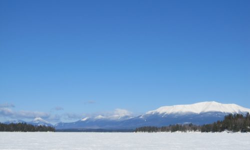
“Here are three photos from my annual school vacation trip to Pemadumcook Lake, all taken from roughly the same spot out on the ice in Deep Cove.” Photos by NRCM member Peter Simmons of Brunswick, Maine To see past My Maine This Week photos, or to submit a photo of your own to be featured Read More
Kennebec River Access
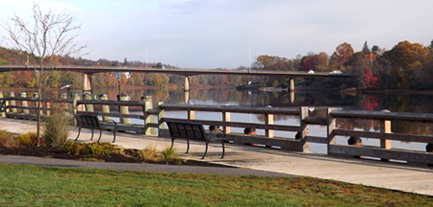
The City of Gardiner acquired land by the mouth of Cobbosseecontee Stream in its historic district that doubles the amount of publicly accessible river frontage in the 10 surrounding towns that border the Kennebec. This 2-acre parcel triples the size of Gardiner’s waterfront park by linking the heavily used boat launch with another State-owned parcel, Read More
New Rules Expected to Slow Residential Solar Power Growth, Advocates Say
By Lauren Abbate, BDN Staff Bangor Daily News news story Solar power advocates are concerned that new rules approved by the Maine Public Utilities Commission last month, and finalized in an order Wednesday, will slow residential solar power growth in Maine. The rules reduce the credits homeowners receive under state’s net-metering policy for the excess Read More