Maine’s Acadia National Park is a popular hotspot for Mainers and visitors alike. But did you know Maine also hosts other protected federal lands that make great exploration destinations? Located throughout the state, these federally protected areas are great escapes for a wide range of usage. It’s more important than ever to show your support right now for these lands, and summer in Maine is a glorious time to do so, NRCM staff and members share with you here a few favorites. Explore more by checking out the full list of federally protected areas at our website at nrcm.org/our-maine/explore-maine. Explore and enjoy!—Allison Wells, Editor
Francis Perkins National Monument, by Todd Martin
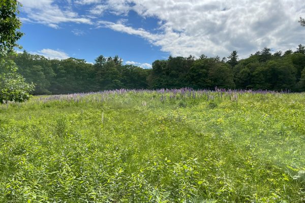
Frances Perkins National Monument
Located on River Road in Newcastle, just a few miles north of the popular Dodge Point Preserve, this site is one of the newest additions to the National Park Service. Designated by President Biden in December 2024, the Monument preserves the family homestead of our nation’s first female cabinet secretary, Frances Perkins, who served as Labor Secretary under FDR. In addition to the historic Brick House, ell, and barn, built in 1837, the site includes 57 acres to explore along the Damariscotta River. With maintained hiking trails open year-round dawn to dusk and traversing through woodlands and fields, the Monument is a great place to mix hiking and history. After parking, walk around the outside of the barn to find a kiosk marking the trailhead. The hike begins through the woods on a wide path, with vibrant green ferns dotting the understory. At about the ¼-mile mark, you’ll come to a fork to take either the north or south trail, which form a loop. Soon you’ll emerge into a field bursting
with purple and white lupin in June and July. During my hikes at the site, I’ve never failed to see Wild Turkeys and white-tailed deer foraging in the fields. Along the way, you’ll see the remnants of an 18-century building foundation as well as a garrison site dating to the 1740s. The north and south trail converge at the southern edge of the field and a rustic trail, the shore path, leads to the remains of a family brickyard at the Damariscotta River.
—Todd Martin, NRCM member
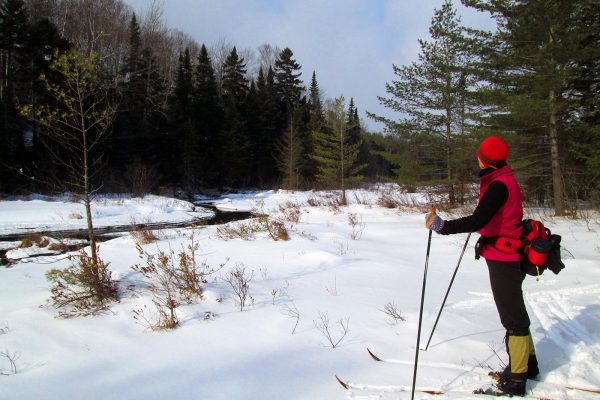
Skiing at KWW National Monument, courtesy Leslie Burhoe
Katahdin Woods & Waters National Monument
The Katahdin Woods & Waters National Monument (KWW) is one of the jewels of Maine. Not only for its beautiful views, woods, and rivers, but also because of its history and ALL the peoples its land has hosted and cared for. My first visit to the land that became KWW was in 2012 on a cross-country ski trip to Haskell Hut. It wasn’t a monument yet. Our group enjoyed the total quiet, breaking trail to hidden ponds, identifying animal tracks, and watching the mostly frozen East Branch of the Penobscot River. I have been back many times since skiing, hiking, birdwatching, and driving the loop road. I have gone in through the North Entrance and the South, each trip providing something new: The walk in the North Entrance, still closed for mud season in June of 2021, when the mosquitoes were as big as Red-tailed Hawks! The hike to the top of Barnard Mountain to see the fall colors. The ski in the North Entrance in 2023 when the thermometer read minus 30 degrees F. The drive around the Katahdin Loop Road when we watched a black bear lumber off the road. The view of Katahdin. And the many views of the East Branch flowing and frozen. Now that KWW is a National Monument, you can plan your trip from the website. There are more marked trails and campsites, a visitors’ center—Tekαkαpimək Contact Station, created in partnership with the Wabanaki Nations and scheduled to open June 21—and space to wander Maine’s North Woods and the glories it contains!
—Leslie Burhoe, NRCM member
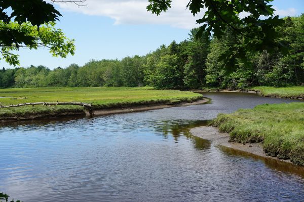
Mousam River on Rachel Carson Trail, Wells, by Laura Pope
Rachel Carson National Wildlife Refuge
Eleven protected parcels of land totaling more than 9,000 acres form the Rachel Carson National Wildlife Refuge (RCNWR), a collective of ecosystems featuring nature trails and observation stations highlighting habitat, flora, and fauna dotting the coastline from Cumberland to Kittery. The RCNWR in Wells features the looping one-mile Carson Interpretive Trail, where a canopy of mixed forest yields cool, dappled light, with the Merriland River flowing alongside. Farther along, the tidal salt marsh appears, culminating in an expansive collective habitat of forest, river, marsh, and sea. One of eleven interpretive observation decks appears at this junction of ecosystems, offering a clear viewpoint of where the Merriland River meets the Little River and together, course eastward to the sea. The full breadth of the salt marsh is a haven for wildlife. On a recent visit, we saw an egret in flight, a group of Canada Geese and ducks, and heard the unmistakable calls of a Belted Kingfisher. As the trail loops back toward the trailhead, the Little River appears on its way to meet the Merriland River. I think of and thank Carson for her enduring legacy of coastal habitat preservation whenever I walk the many trails in the Rachel Carson National Wildlife Refuge. The Carson Trail is an easy walk, perfect for all ages, and is accessible to wheelchair users and strollers. No bicycles are allowed, and pets must be leashed.
—Laura Pope, NRCM member
Anya hiking the 100 Mile Wilderness, courtesy of Anya Fetcher
Appalachian Trail
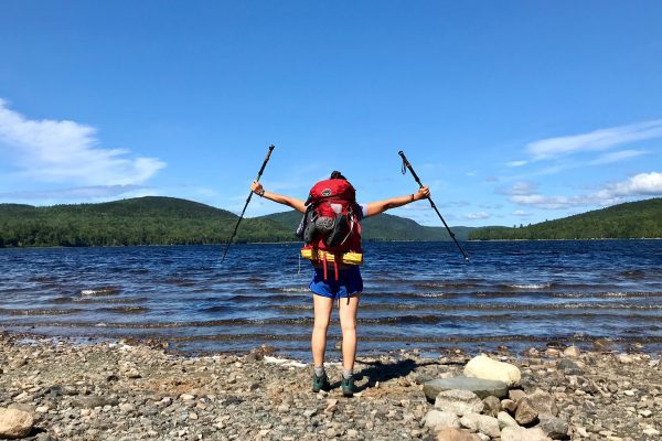
My first fall living in Maine, I decided to backpack the 100 Mile Wilderness, a particularly wild, dense, remote section of the Appalachian Trail that (going north) ends just a few miles before Katahdin. Prior to doing so, the majority of my hiking and backpacking experience had been in the West, where the mountains are giant and the views are vast and open. So when I was met with three days of near-constant rain, dense forests, and thick fog at every summit, I was admittedly a bit disappointed. But as I realized I wasn’t going to get much of a view looking up and out, I started to look down and around. What I discovered was the most magical world right at my feet: neon orange fungus crawling over fallen trees; carpets of soft, lush moss; mushrooms sporting all colors of the rainbow—some tiny and delicate, others firm, strong, and bigger than my face. Taking the time to look closely at Maine’s natural beauty on a micro scale helped me to slow down and appreciate all the aspects of these wild places, and
the experience has enhanced my hiking adventures since then. Oh, and I did finally get that big view when I summited Katahdin just a few weeks later!
—Anya Fetcher, NRCM Federal Policy Advocate
Petit Manan, by Emmie Theberge
Petit Manan Point (Petit Manan National Wildlife Refuge)
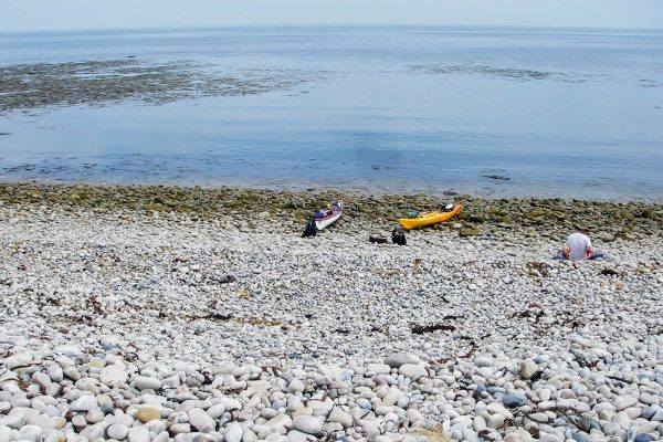
During a multi-day sea kayaking trip from Bar Harbor to Machiasport, we paused on Petit Manan Point for a well-earned lunch break. We landed on the sweeping
cobblestone beach that wraps around the point and settled atop a rugged berm of cobblestones, which separates Big Pond from the open Atlantic. Though not the most comfortable spot for lounging or a picnic, this wild, stony perch offered dramatic views of Petit Manan Island and its lighthouse—a perfect snapshot of the raw beauty that defines Maine’s coastline. Petit Manan Point is shaped by its isolation and harsh maritime climate, which have helped preserve a remarkable diversity of habitats. These include mature woodland groves, freshwater wetlands, estuaries, boreal understory species, coastal bogs, and nearby coastal islands teeming with life. The area has long been recognized as critical breeding habitat for numerous bird species. It’s important to note that accessing this area by kayak is recommended only for experienced paddlers. The Maine Island Trail Association Guide designates it as a hazard zone due to its exposure to open water, shifting tides, strong winds, and large waves.
—Emmie Theberge, NRCM Outreach Director
Moosehorn National Wildlife Refuge, by BComeau/NRCM
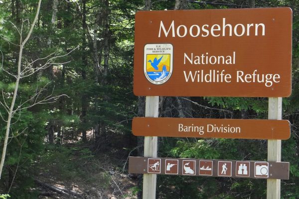
Moosehorn National Wildlife Refuge
Moosehorn National Wildlife Refuge (MNWR) is so far Downeast you can almost hop over to Canada from its northernmost section. Established in 1937 as one of the first in the nation, MNWR now holds almost 30,000 acres of wildlife habitat within its two sections. The refuge has had a long-term priority of managing habitat for American
Woodock and waterfowl, but its more than 50 miles of dirt roads, closed to vehicles, give ample opportunity to see an impressive diversity of birds, mammals, and other creatures. The headquarters is located in the northern section, called the Baring Division, and is perhaps best known for its marshy wetlands that are great for waterfowl. The southern section, called the Edmunds Division, is located near Cobscook Bay State Park. Its trails are particularly known by birders for the sprucefir forest habitat that attracts so-called boreal specialty species like Canada Jay, Black-backed Woodpecker, and Cape May and Bay-breasted Warblers. Allison and I always find the bird watching is outstanding, and the refuge is also home to a diversity of mammals including, of course, moose!
—Jeff Wells, NRCM member
White Mountain National Forest, by Olivia Ruhlin
White Mountain National Forest
The White Mountain National Forest is an extraordinary expanse of protected wilderness stretching across New Hampshire and a portion of western Maine. Managed by the U.S. Forest Service, this national forest is preserved for its ecological value, recreational opportunities, and cultural significance. Home to rugged mountains, scenic
trails—including parts of the Appalachian Trail— and diverse wildlife, it plays an important role in conservation, watershed protection, and outdoor recreation. This forest not only supports local economies through tourism but also protects critical habitats and preserves the natural beauty of the northeastern U.S. for future generations. Growing up in Cornish, I felt lucky to have lived only an hour away from such an exquisite place. I have fond memories of family hikes, swims, and bike rides—all usually with a dog in tow—in these beautiful woods.
—Olivia Ruhlin, NRCM Franklin County Regional Outreach Coordinator
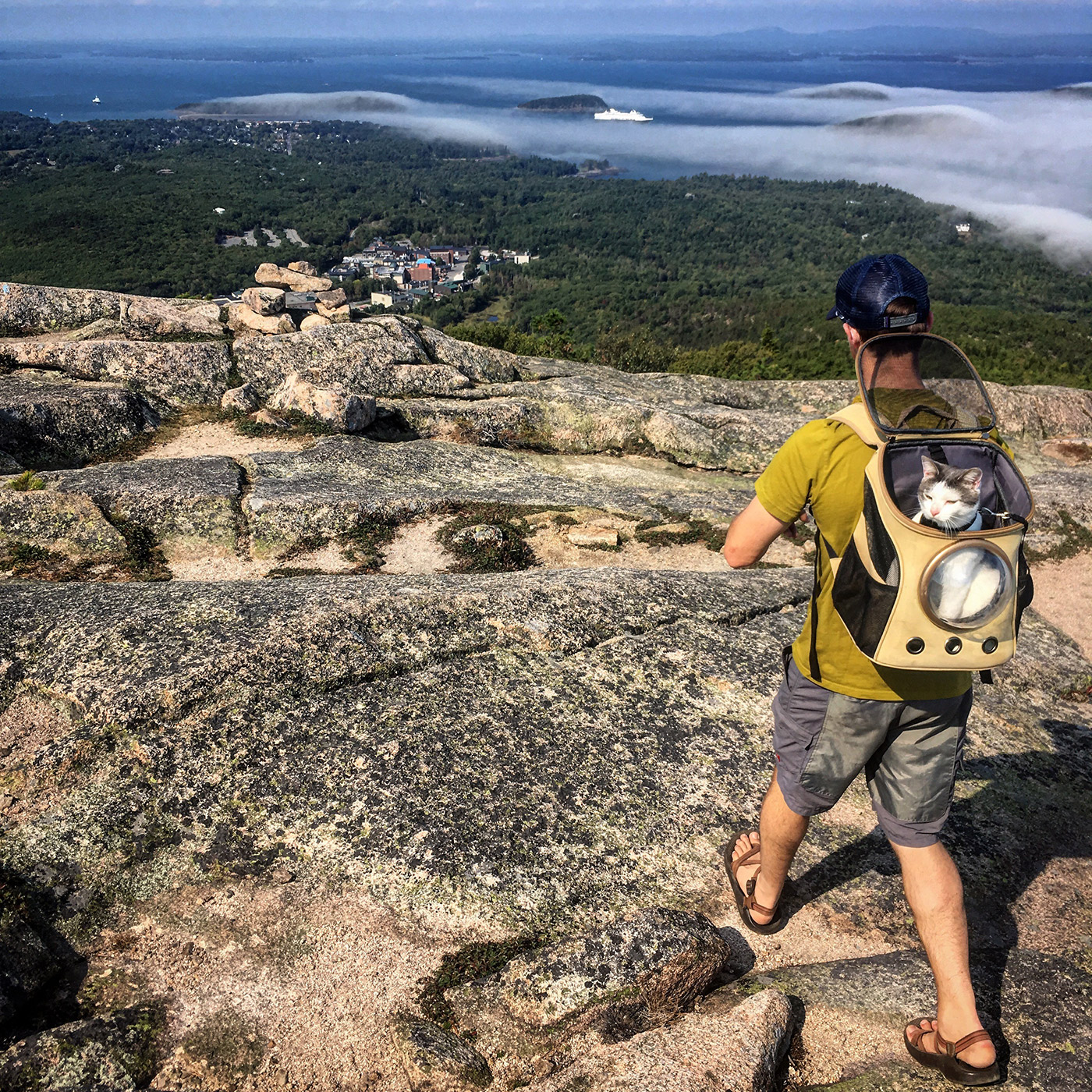
Hiking at Acadia, courtesy Nate Hathaway
Acadia National Park
What we know today as Acadia National Park certainly lives up to the motto: Geography is Destiny, with a dramatic central fjord of Somes Sound encircled by the summits like Penobscot, Cadillac, Sargent, and Pemetic Mountains, among others. From the approach to the causeway, which connects the North side of Mount Desert Island to the mainland, the summits rise majestically from Penobscot Bay to the West and Frenchman Bay to the East. This dramatic, glacial carving of the island has led to some really neat glacial erratics, as well as climbing opportunities for the vertically inclined along Otter Cliffs and farther up Champlain Mountain, among other areas. If you don’t have the technical skills but still want the thrills, I highly suggest the Beehive Loop—at 1.4 miles it’s no marathon, but the route incorporates some scrambling and ladders that will make you feel like one of the park’s Peregrine Falcons, overlooking Sand Beach with excellent views south and east from the summit. For a similar view, but half the effort and risk, try Flying Mountain near Southwest Harbor, and you’ll be treated to a view of Somes Sound and smaller (if any) crowds.
—Nate Hathaway, NRCM Penobscot Bay-Frenchman Bay Regional Outreach Coordinator